
Hello all - as you well know, I've not been updating T.U.C. for the past few months. My graduate work has picked up considerably, leaving little time for all things blog related.
I do hope to continue posting here in the future...but don't hold your breath.
best,
Michael
Wednesday, October 13, 2010
Monday, August 2, 2010
Sunday, June 13, 2010
Slowing the City
Hello Folks - sorry for the hiatus there. Things got busy with diagnostic exams at the end of the spring semester, and teaching a statistics course during the first summer session. But let's kick off the summer blog season right now! Also, keep a look out for a post or two on urban renewal projects in Beijing by a current resident of that city, Tyler C.
-------------------------------------------------------------
 I like to think that an important part of our everyday urban experience is our familiarity with the material - the cracks, curves, and colors of the landscape we move through.
30 mph driving, 15 biking, 6 running, 3 walking, 0 sitting.
Speeding through the city in our car limits our ability to accumulate information - to experience our place. But traveling through the same space more slowly might tell a different story - one which can dramatically complicate our impressions of an unfamiliar area.
 Walking to Hertel Ave. the other day I thought about a book I read a while ago on mobility and motion - and thought I'd pass on the reference. Tim Cresswell's On the Move: Mobility in the Modern Western World is a well written, easy to read 'academic' stroll through the history of movement and spaces in the west. What I found most appealing is its discussion of how simple movements of the human body helped shape the social and economic landscape we presently inhabit.

On a related note, I wanted to share this link a friend sent to me. It calculates a 'walkability' score for your address by searching for nearby restaurants, grocery stores, public transportation, entertainment opportunities, parks, etc. What's your score?
http://www.walkscore.com/
-------------------------------------------------------------

30 mph driving, 15 biking, 6 running, 3 walking, 0 sitting.
Speeding through the city in our car limits our ability to accumulate information - to experience our place. But traveling through the same space more slowly might tell a different story - one which can dramatically complicate our impressions of an unfamiliar area.

On a related note, I wanted to share this link a friend sent to me. It calculates a 'walkability' score for your address by searching for nearby restaurants, grocery stores, public transportation, entertainment opportunities, parks, etc. What's your score?
http://www.walkscore.com/
Monday, April 12, 2010
2 Papers at AAG 2010 - DC
I'm heading to the American Association of Geographers Annual Meeting in DC to present a paper on urban gardening/farming ("Planting Place: Examining Spatial Meanings in Post-Industrial Cities through Reactions to Urban Agriculture") and I am a co-author on a piece with Sara Metcalf entitled "S(t)imulating (S)pace: Cultivating a Postmodern Geographic (Con)science."
The two abstracts and presentation times are presented below - please swing by if you're at the conference!
Planting Place: Examining Spatial Meanings in Post-Industrial Cities through Reactions to Urban Agriculture
Thursday, 4/15/10 at 12:40 PM.
Author(s):
Michael J. Widener* - University at Buffalo
Sara S. Metcalf, PhD - University at Buffalo
Abstract:
Urban agriculture has gained considerable momentum in post-industrial Rust Belt cities over the past few decades, evidenced by an increasing number of community organizations partaking in the practice. With the emergence of community gardens and urban farms, a corresponding discourse about the meanings of urban space has begun to take shape in local media, politics, and communities. While not all reactions to urban farming are negative, the presence of dissent implies that what is at stake is more than food. At the heart of these discussions is the question - how can cities with increasing numbers of vacant lots, low income residents, and high unemployment rates restructure themselves to better serve their inhabitants?
Drawing upon analysis of media reports and public records relevant to the case of Buffalo, NY, this paper assesses local reactions of various actors to points of crisis where expectations of urban spaces are defied by the transgression of agriculture. However, the idea that previous land use must be perpetuated is diminishing. Such analysis reveals how meanings of place are challenged and transformed through changing land use practices, the development of local food economies, and new centers for community organization. Revised conceptions of the urban landscape then provide a context in which future planning and policy discussions can take place.
S(t)imulating (S)pace: Cultivating a Postmodern Geographic (Con)science
Saturday, 4/17/10 at 8:00 AM.
Author(s):
Sara Metcalf* - University at Buffalo
Michael Widener - University at Buffalo
Abstract:
At their best, simulation models link system structure to behavior for the purpose of changing structure to improve behavior. Because of this implicit normative emphasis, this paper (re)asserts the mutual relevance of critical social theory and simulation science. Placing postmodernism (and parentheses) in the title serves to underscore the multiplicity of meanings that can be inferred from a single string of text. Simulation is linked to stimulation, following from Resnick's (1994) emphasis on the latter goal. Space is linked to pace, the intrinsic dynamics of complex systems that manifest in spatial memory. The notion of "stimulating space" recalls the reflexive socio-spatial dialectic (Soja 1989) in the context of computer simulation, emphasizing the subjective role of the modeler in shaping model structure and outcomes. The (perhaps) counter-intuitive notion of a "postmodern science" may be mitigated by reading the latter as conscience, reaffirming the significance of subjectivity in harnessing science for the purpose of the common good. When used systematically, simulation models provide the opportunity to experiment with social theories infeasible (or otherwise inadvisable) to test in the "real" world. As an example, this paper outlines how the discounting of environmental concern with human experience in space-time may be explored through inclusion of mental models in software agents. While such models are never strictly true, through the iterative practice of modeling, they can become more relevant to system stakeholders, whose participation helps to expose and expand model boundaries to include information feedback and sources of delay beyond the perspective of the modeler.
Monday, March 15, 2010
Transportation Engineering @ UToronto
Sara Metcalf (my adviser) gave a talk on sprawl and agent based models in the Civil Engineering Department at the University of Toronto last week, and I tagged along so I could partake in the following group discussion (and because it gave me an excuse to go to Toronto).

I came away very impressed by what the group there, under the direction of Eric Miller, was doing. Particularly of interest to me was the work they are doing with their ILUTE (Integrated Land Use Transportation Environment) Modeling System.
 In order to evaluate larger transportation issues in the greater Toronto metropolitan area the group has spent a fair amount of time and energy on understanding broader social issues that invariably have significant effects on how and why people move and travel. However, because they have managed to create a microsimulation modeling environment that can handle, computationally, an urban area as large as Toronto, my impression is that some of the behavioral models have been greatly simplified (i.e. a marriage/divorce market). I'd like to learn more about how that, and other, behavioral factors are programmed - and perhaps it would be beneficial to look into developing a more complex behavioral model at a smaller scale (say, just a portion of the Toronto area).
Check out their site here: http://www.civil.engineering.utoronto.ca/research/transport/subpages/ilute.htm
I came away very impressed by what the group there, under the direction of Eric Miller, was doing. Particularly of interest to me was the work they are doing with their ILUTE (Integrated Land Use Transportation Environment) Modeling System.
In order to evaluate larger transportation issues in the greater Toronto metropolitan area the group has spent a fair amount of time and energy on understanding broader social issues that invariably have significant effects on how and why people move and travel. However, because they have managed to create a microsimulation modeling environment that can handle, computationally, an urban area as large as Toronto, my impression is that some of the behavioral models have been greatly simplified (i.e. a marriage/divorce market). I'd like to learn more about how that, and other, behavioral factors are programmed - and perhaps it would be beneficial to look into developing a more complex behavioral model at a smaller scale (say, just a portion of the Toronto area).Check out their site here: http://www.civil.engineering.utoronto.ca/research/transport/subpages/ilute.htm
Saturday, March 6, 2010
Making a Scene
 Michael's Note:
This post is by a good friend from Memphis who's currently a musician living in NYC and a brilliant and funny writer.
I asked him if he would write a short piece on "cities and music" and his post follows... If you have the time, please check out out his blog (he's a much more frequent poster than me) and site. If he is playing at a venue near you, definitely try to make his show!
--------------------------------
--------------------------------
Ladies and gentlemen, dogs and cats, interlopers and cybermen: meet Michael.
Michael is a graduate student at Buffalo, where he studies people. Specifically, he studies migration, cities, geography, satellites, and (I believe) the history of lasers. I'm not sure. He's also the Blother (blog-author) of the Urban Complex, where he discusses how our cities work, how they don't work, how they might change to meet 21st century demands, and what lasers have to do with all of this (again, I might be making the lasers up). He's a smart fellow. In fact, he's a Fellow fellow, which I think involves a scholarship, high academic honors, and powdered wigs.
But I know Michael a different way: he was the guitarist and songwriter of my first band (we had many names, but my favorite was "Styrofoam Giraffe"). Back in high school, Michael and I formed a band and gigged around the Memphis suburbs like Hanson with buzzcuts. I would never tell him this now, except indirectly and with a modicum of ridicule, but Mike set the bar for every guitarist I've worked with since, as a musician, bandmate, and friend. I've always suffered the "artistic type" badly, because Mike's living proof that talented people don't need to be difficult people. I learned that from him early, and have carried it with me since. He's a great guy.
So, when he recently asked me to write "something" about New York and/or Nashville for the Urban Complex, I agreed. Of course, I know nothing about city development, human migration patterns, and/or lasers. I know the shortest route to ice cream wherever I am--that's the extent of my urban expertise. Still, I thought "I'm (fairly) urban and (potentially) complex. I can do this!"
And then a Mailbag question gave me my topic, like an email from the heavens (angels use Yahoo, by the way): "Hey Chris, what's the difference between a show in New York and a show somewhere else, say Nashville?"
Eureka!
 Of course, the differences (and the reasons for those differences) are many and varied. But perhaps the biggest difference is also the most relevant to the Urban Complex: New York's layout affects its music scene in a unique and (I believe) positive way.
The first thing I noticed going to shows in New York (and playing my own) was how crowded all the rooms were. Every noteworthy venue was full most nights, rain or shine, early or late, seemingly regardless of the bill. Even open mics were well-attended by seemingly non-partisan crowds. This wasn't happening because New York crowds love music more than anywhere else (although they are great, active, engaged fans). Established venues in town have a built-in audience--regulars that come to have some drinks, hear music, and generally "check it out" on a nightly basis. Elsewhere (e.g., Nashville), artists have a crowd, but the room doesn't; your audience is generally whomever you bring.
There are many explanations for this, but I'll give three:
1) Population/density. The more people are in a city, the more crowded its places will be. Also, the sun is hot and puppies are cute.
 2) Driving culture. This is the big one. Though New York has every mode of transportation in abundance (excepting rickshaws), it's primarily a walking culture. Rather than drive five minutes to Kroger, you walk five seconds to the bodega. Rather than drive to your favorite strip of restaurants/bars in town, you walk to your favorite block and hop around. While living in the city encourages real exploration, day-to-day life is about walking around the autonomous micro-city that is your neighborhood. Of course, you should leave your neighborhood; but (depending on where you work) you might not have to.
So, walking three minutes to your favorite restaurant/bar could double as a trip to hear some free music. If you live in the Lower East Side (and seemingly nine billion people do), you're likely a stone's throw from Rockwood, the Living Room, Mercury Lounge, Arlene's, and Pianos, to name a very few. If you live just a few blocks north, add in the Bowery, Webster Hall, Joe's Pub, Bitter End, Kenny's, and dozens more. In total, I'm talking about a 20-block radius. I personally live in the East Village (slightly further) and can easily walk to all of these venues. It's one of the reasons I picked this neighborhood--quick accessibility to a lot of music.
 In other words, you don't have to "make a night" of seeing a concert at a destination across town; you can just swing by and check it out. And a ton of people do this.
Now, this isn't unique to New York--art districts in other cities make it easy for some locals to walk to venues. This typically happens only in our most populous (and most densely populated) cities, like Chicago and San Francisco. But it is different from cities like Nashville and Memphis, which have a smaller population, a sprawling city plan, and dominant driving culture. Which leads me to...
3) Really, an offshoot of #2: college-kid accessibility. Young people are obviously the lifeblood of any local music scene, specifically anyone from 16-30. In a small town without a local college, venues are geared toward high school students. In some bigger towns without a nearby college, venues target the twenty-something crowd. But for college-towns and college-heavy cities like Nashville and New York, undergrads are a huge percentage of the concert-going public. They're also the ideal audience: they're more open and independent in their tastes than high school kids, generally have disposable income, and have more free nights (and less responsibilities) than the post-grad crowd. Hence, collegians are vital to the activity and success of their local music scene.
But Nashville's music venues aren't readily available to its many colleges (Vanderbilt, Belmont, Lipscomb, Fisk, TSU, and MTSU in Murfreesboro). Sure, fans go to concerts in town--Nashville's a great city for music and the fans there are active. But, again, the issue is accessibility. If I went to NYU, I could walk to the Bitter End in the same time that a trip to the library took at Vanderbilt. What's more, Nashville's venues are staunchly 21+, whereas NYC rooms seem slightly--cough, cough--more lax. They know their location, and they know their audience.
 So, while both cities have amazing fans, it's simply easier for those fans to find music in New York. That's been the greatest difference for me, gigging as a nascent artist in the city: the crowd's not just who I bring. Anyone can impulsively decide to walk five minutes, drop by the right open mic at the right room at the right time, play two songs, and potentially walk away with forty new fans. It's endlessly fun and rewarding from the artist's perspective.
Still, I'd sell a leg right now for a week on I-40 with Ruby.
So, you know, pros and cons.
But what do you think? Is this changing as more cities become less driving-dominant? Is your city developing more autonomous walking neighborhoods (Nashville, for example, has experimented with this over the last decade with mixed results)? Is your favorite venue in town within walking distance? And, if it is, would you actually walk there?
Hit up the Urban Complex and be sure to leave some comments, love, and/or lasers.
(And big props to Mike. Stay tuned for the Styrofoam Giraffe reunion tour.)
Sunday, February 28, 2010
Can slum cities save the planet?
 Here is an interesting article I came across that examines the massive "slum cities" that have developed around some of the world's major metropolitan areas as more and more folks move from the countryside. The basic thesis of the article is that the slum city is an organic, self organizing system that is constantly restructuring itself to become more efficient and equitable.
I think the article might simplify the larger social issues here by under-emphasizing the relationship between the slum city (the have-nots) from the wealthier urban and suburban areas (the haves). But, it does capture the resilience and ingenuity of humans - and I would agree that there is much we can learn from super-compact living.
Also, check out this video of a market in Thailand:
http://www.prospectmagazine.co.uk/2010/01/how-slums-can-save-the-planet/
Saturday, February 20, 2010
Video of Pittsburgh
I just had to share this video...I recommend viewing it full screen:
HD Pittsburgh Clips from Brian Lippert on Vimeo.

HD Pittsburgh Clips from Brian Lippert on Vimeo.
Friday, February 19, 2010
Evacuation Model 2.0
I'm working on implementing the simple evacuation model (which I posted about earlier) in AnyLogic. I think I'll be able to post a working version on this site.
Update soon...

In other news, A friend passed along this article from Seed Magazine. Check it out if you're in for a good discussion piece on the limits of urban growth/ecological resilience - and how that might affect all things economic and social.
http://seedmagazine.com/content/article/urban_resilience/
Update soon...
In other news, A friend passed along this article from Seed Magazine. Check it out if you're in for a good discussion piece on the limits of urban growth/ecological resilience - and how that might affect all things economic and social.
Questions of green space and optimal urban density are just the beginning. Can the world’s mega-cities keep growing? Are other patterns of urban growth preferable? Urbanization is inevitable, but can it be directed so that cities can be harnessed as generators of innovation, and core contributors to future sustainability? As scientists make headway on these macro-issues, can they develop tools to help decision-makers build for social, economic, and ecological resilience?
http://seedmagazine.com/content/article/urban_resilience/
Monday, February 15, 2010
Spatial Data by State (MIT)
For those that need data:
Spatial Data on the Web by State: MIT GIS Services
Spatial Data on the Web by State: MIT GIS Services
Friday, February 12, 2010
iGIS Review
Elsewhere in blog-splace, Willis (who seems to be going through a software review phase) has posted a review of the iGIS app, the "first GIS for your iPhone".
Tuesday, February 9, 2010
Repast Simphony: A Feast for the Mind
Mike recently posted a one-off model of urban evacuation, written in the NetLogo modeling language. NetLogo is a wonderful toy, and the environment as a whole is a great way to introduce agent-based modeling (ABM) to university students who have little programming experience; perhaps its best feature is the ability to get "down and dirty" with coding your own models from the start.
Ultimately, however, the utility of NetLogo for "serious research" is questionable, and it is arguably better suited for illustration (as Mike has used it here), rather than serious mathematical analysis. Often, the simple syntax of the NetLogo environment constrains its applicability to real-world problems, since models must conform to the "turtles and patches" spatial structure upon which NetLogo is founded.
The alternative is to learn OOP (C/C++, Java). This would, of course, allow you to construct models "from scratch", but learning a new programming language is demands a serious investment of time and/or money. Not to mention that much of the syntax you memorize at the outset will ultimately prove useless in finding the ABM perfection that you seek.
Enter Repast Simphony. Repast - aka the REcursive Porous Agent Simulation Toolkit - is the greatest open source software that you never knew existed. Like NetLogo, Repast is based upon Java. Like NetLogo, Repast is free. Unlike NetLogo, Repast complexifies, rather than simplifies, the process of modeling.
The list of features alone mark Repast out as a "serious" ABM tool, intended for conceptually and computationally heavy research. First, models can be developed using Java, Groovy (a Java language), or flowcharts, or any combination thereof. Repast also features automated connections to the R statistics environment, *ORA, SQL databases, VisAD (Visualization), Weka (datamining), and MATLAB, allowing for the easy mathematical analysis of the complex and emergent behavior generated by ABMs. Importantly, Repast has a very flexible definition of space, allowing you to chose between 2D space, 3D space, network space (using JUNG). Most importantly, Repast allows you to use "geographic" spaces derived from 2D and 3D GIS data. Finally, for those computationally heavy models that require a neutronium-supercolliding-computer to complete (ahem, Mike), Repast supports distributed computation with Terracotta, letting you tie up your department's computer lab for days on end.
So what's the catch? The learning curve is much, much steeper than Netlogo. Ideally, you should already be familiar with OOP and the basic syntax of Java or C/C++ before you attempt the tutorials. Even the flowchart interface requires you to know how to call Java functions - think "int myX = grid.getLocation(this).getX()" - in order to build your model. In fact, having worked through several of the Repast tutorials myself, I can say that attempting to learn Repast in the flowchart interface alone can be even more confusing than learning to code alone, in part because syntax errors are much easier to make, but mostly because it is difficult to see how the different parts of you model interact
The ultimate results of modeling in Repast are, however, indisputably impressive. Given enough time, willpower, and a willingness to repeatedly pound your head against the keyboard, Repast has the potential to generate the most complete - and completely analyzed - ABMs in use today.


Flocking Bird (with network connections on the right)

Ultimately, however, the utility of NetLogo for "serious research" is questionable, and it is arguably better suited for illustration (as Mike has used it here), rather than serious mathematical analysis. Often, the simple syntax of the NetLogo environment constrains its applicability to real-world problems, since models must conform to the "turtles and patches" spatial structure upon which NetLogo is founded.
The alternative is to learn OOP (C/C++, Java). This would, of course, allow you to construct models "from scratch", but learning a new programming language is demands a serious investment of time and/or money. Not to mention that much of the syntax you memorize at the outset will ultimately prove useless in finding the ABM perfection that you seek.
Enter Repast Simphony. Repast - aka the REcursive Porous Agent Simulation Toolkit - is the greatest open source software that you never knew existed. Like NetLogo, Repast is based upon Java. Like NetLogo, Repast is free. Unlike NetLogo, Repast complexifies, rather than simplifies, the process of modeling.
The list of features alone mark Repast out as a "serious" ABM tool, intended for conceptually and computationally heavy research. First, models can be developed using Java, Groovy (a Java language), or flowcharts, or any combination thereof. Repast also features automated connections to the R statistics environment, *ORA, SQL databases, VisAD (Visualization), Weka (datamining), and MATLAB, allowing for the easy mathematical analysis of the complex and emergent behavior generated by ABMs. Importantly, Repast has a very flexible definition of space, allowing you to chose between 2D space, 3D space, network space (using JUNG). Most importantly, Repast allows you to use "geographic" spaces derived from 2D and 3D GIS data. Finally, for those computationally heavy models that require a neutronium-supercolliding-computer to complete (ahem, Mike), Repast supports distributed computation with Terracotta, letting you tie up your department's computer lab for days on end.
So what's the catch? The learning curve is much, much steeper than Netlogo. Ideally, you should already be familiar with OOP and the basic syntax of Java or C/C++ before you attempt the tutorials. Even the flowchart interface requires you to know how to call Java functions - think "int myX = grid.getLocation(this).getX()" - in order to build your model. In fact, having worked through several of the Repast tutorials myself, I can say that attempting to learn Repast in the flowchart interface alone can be even more confusing than learning to code alone, in part because syntax errors are much easier to make, but mostly because it is difficult to see how the different parts of you model interact
The ultimate results of modeling in Repast are, however, indisputably impressive. Given enough time, willpower, and a willingness to repeatedly pound your head against the keyboard, Repast has the potential to generate the most complete - and completely analyzed - ABMs in use today.
Surface Model 2D/3D

Autocatalysis Model 2D/3D

Flocking Bird (with network connections on the right)

Thursday, February 4, 2010
follow up on adaptive reuse
Here is a Facebook group I came across a week ago calling for the Pyramid in Memphis, TN to be turned into a museum of contemporary art. If done right, this could be a great opportunity for Memphis - but it would take a tremendous amount of effort and capital. Perhaps in addition to an art museum there could be a substantial exhibition on the areas rich music history.
Check it out:
http://www.facebook.com/group.php?gid=278888807122

Check it out:
http://www.facebook.com/group.php?gid=278888807122
Friday, January 29, 2010
Simple Evacuation Model in Netlogo
After talking with some colleagues about the problem I decided to construct a simple model that simulates how people in a city who are told to evacuate might make the decision to leave or stay. It is documented that many people either choose not to evacuate after being warned while many others simply can't because they lack the means (transportation, social network outside of their neighborhood, etc.).
The model is straight forward - a user specified number of agents are chosen to receive the evacuation notice. Every cell is randomly assigned a decision value that represents the likelihood that they'll actually leave. If that value is above some threshold, then the cell decides to evacuate (represented by green), otherwise they'll stay (red). The blue cells haven't heard one way or the other about the evacuation.

Next all the cells look at their neighbors and see if they've received the evacuation notice - if they haven't nothing changes. If their neighbors have made a decision it will affect the previous mentioned decision value either positively (if their neighbor is evacuating) or negatively (if their neighbor is staying put).
What we see is that there are random cells throughout the region that decide to stay - and also larger clusters (neighborhoods).

It is a very simple model - but I think it captures some of the dynamics of this process. Here is a link to the model: http://www.acsu.buffalo.edu/~mjwidene/evacmodel.nlogo (NOTE: Right click and save as - otherwise you'll get text. Also you need Netlogo to run the program).
And for those interested here is the code:
patches-own [aware? prob-evac evacuate? influence no!]
to setup
ca
ask patches[
set aware? 0
set pcolor blue
set prob-evac random-normal .5 .3]
repeat num-initial[
ask one-of patches[
set aware? 1
set pcolor orange]]
setup-initial-decision
end
to setup-initial-decision
ask patches with [aware? = 1] [
ifelse (prob-evac > .5)
[set evacuate? 1
set pcolor green]
[set evacuate? 0
set pcolor red]
]
end
to go
display
ask patches[
if (prob-evac < .1)
[set no! 1
set pcolor red]
look-at-neighbors
make-decision
]
end
to look-at-neighbors
set influence (count neighbors with [evacuate? = 1])
if (no! = 0)[
set prob-evac (prob-evac + .3 * (influence / 8))]
end
to make-decision
ifelse (count neighbors with [evacuate? = 1] != 0)
[ifelse (prob-evac > .5)
[set evacuate? 1
set pcolor green]
[set evacuate? 0
set pcolor red]]
[if (prob-evac > 0.1)
[set prob-evac (prob-evac - .1)]]
end
Friday, January 15, 2010
The Chicago "L" system

Whether we call it the "L" the "El" or just "the train," the rail-based transit system in Chicago is definitely one that we locals love and love to hate. Much like most other transit systems in Chicago, the El was designed in a manner to help provide rapid transit to the CBD of Chicago, better known as the Loop. The interstate highway system and the commuter rail system (Metra) are designed in a similar manner.
The L in Chicago remains a very affordable method of transversing many miles of urban Chicago, but the system is really only fast, functional and interconnected if your travel plans lead you to the Loop area. For a traveler who might live in Uptown (perhaps near the Wilson stop on the Red line) and work in Cicero (near the 54th/Cermak stop on the Pink line), travel times are extensive, connections to local buses are infrequent, and the L system becomes a burdensome method of travel.
There are often discussions of expansion of the fixed rail system in Chicago, but little has been done with local, state or federal funding to do much with these ideas. Plans become burdened by battles between wealthier suburban interest groups who prefer money be spent on commuter train expansion (Metra) and poorer, often minority, urban interest groups who would like to see El expansion, outer loop rail construction (connecting the spokes of the current CTA "L" system) and improvement of existing facilities
The battle has implications both for transportation options and for economic development opportunities. There are a plethora of sources that point to the benefits of Transit Oriented Development (TOD) and the benefits for the immediate communities or commercial districts. While the battle for funds begins with appropriations for engineering, planning and construction, the war continues with the longer term implications of economic benefits associated with rapid transit.
Plans for the expansion of the CTA "L" system can be found on the CTA website. Details for the expansion of the CTA Red line from 95th St to 130th St, the expansion of the Orange line from Midway Airport to Ford City Mall, the expansion of the Yellow line deeper into suburban Skokie and the elusive "Circle Line" are detailed on the site (more discussion of this plan will follow).
Subways
Or, Five. Five dollar. Five dollar sub-fare.
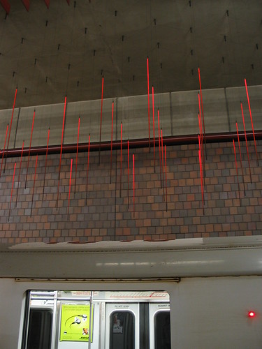
Over the past few weeks I made my way to Boston and Washington, D.C. and got to utilize their respective rail systems (the T and Metro) a good amount. I have to say that I found riding the T to be a much better experience (despite it being an older system) thanks mostly to the bustling and vibrant atmosphere underground. Where the T had vendors and art, the Metro had dark brown signs reminding you not to drink or eat and brutalist architecture.
Maybe this has to do with the system being located in the nation's capital (no tomfoolery allowed), but it all seemed a little excessive. Being underground in the D.C. stations left me thinking that adding a human touch could go a long way.
Then again, it got me where I needed to go relatively quickly and for only a few bucks.
Here is a site passed on to me by a friend that has some wonderful images from subway stations around the world. Maybe one day D.C. will renovate their system to make the underground experience a little less depressing!
http://www.designboom.com/weblog/cat/9/view/8346/subway-architecture.html

Look for future blogs on the impact increased ridership might have on current subway infrastructure and on the question of 'how hard is it to add new lines to current systems?' For the latter post, I'll look at how subway construction in Buffalo, NY killed a once vibrant part of the downtown.
I know my experiences on these systems (and most other large city subways) are limited - so if you know them better I'd be interested to hear your impressions.
Over the past few weeks I made my way to Boston and Washington, D.C. and got to utilize their respective rail systems (the T and Metro) a good amount. I have to say that I found riding the T to be a much better experience (despite it being an older system) thanks mostly to the bustling and vibrant atmosphere underground. Where the T had vendors and art, the Metro had dark brown signs reminding you not to drink or eat and brutalist architecture.
Maybe this has to do with the system being located in the nation's capital (no tomfoolery allowed), but it all seemed a little excessive. Being underground in the D.C. stations left me thinking that adding a human touch could go a long way.
Then again, it got me where I needed to go relatively quickly and for only a few bucks.
Here is a site passed on to me by a friend that has some wonderful images from subway stations around the world. Maybe one day D.C. will renovate their system to make the underground experience a little less depressing!
http://www.designboom.com/weblog/cat/9/view/8346/subway-architecture.html
I know my experiences on these systems (and most other large city subways) are limited - so if you know them better I'd be interested to hear your impressions.
Tuesday, January 5, 2010
Short intermission
Updates are coming soon! I'm presently in Boston - and will be back in Buffalo this weekend.
Subscribe to:
Posts (Atom)
